 |
 |
|
|
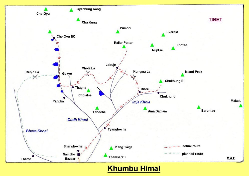
Map of Khumbu Region |
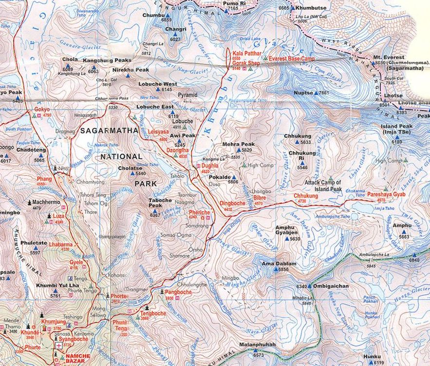 Map of
the Khumbu / Everest Region
( Note: Click here or on map for larger format copy ) |
Map of
the Khumbu / Everest Region
|
Map of
the Khumbu / Everest Region
|
Map of
the Khumbu / Everest Region
|
Map of
the Solo Khumbu Region
|
Map of
the Everest Region
|
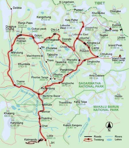
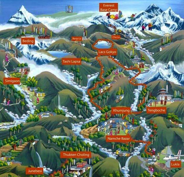 Tourist
Map of the Khumbu /
Everest Region
|
|
|
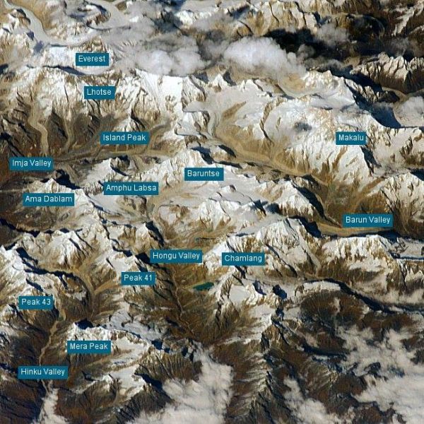 Satellite
view of the Khumbu /
Everest Region
|
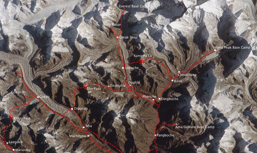 Satellite
Map of trekking routes
in the Khumbu Region
|
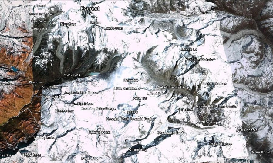 Satellite
Map of the Khumbu Region
|
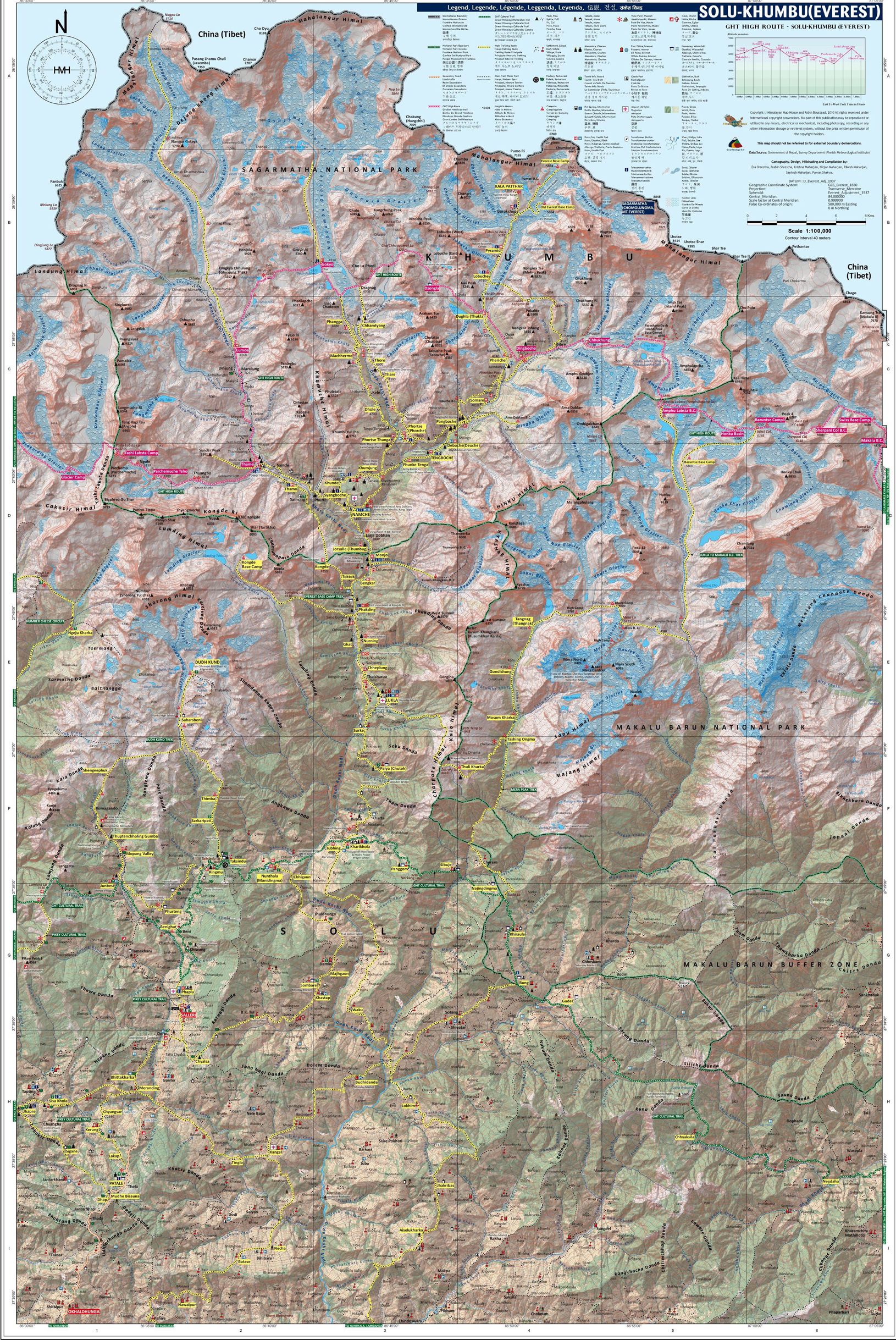 Map of
Great Himalayan Trail through the Everest Region
( Note: Click here or on map for large format copy )  The Great Himalayan Trail traverses the length of the Nepal Himalaya from Kangchenjunga via Everest, Langtang, Manaslu, Annapurna and Dhaulagiri to the Western border with India |
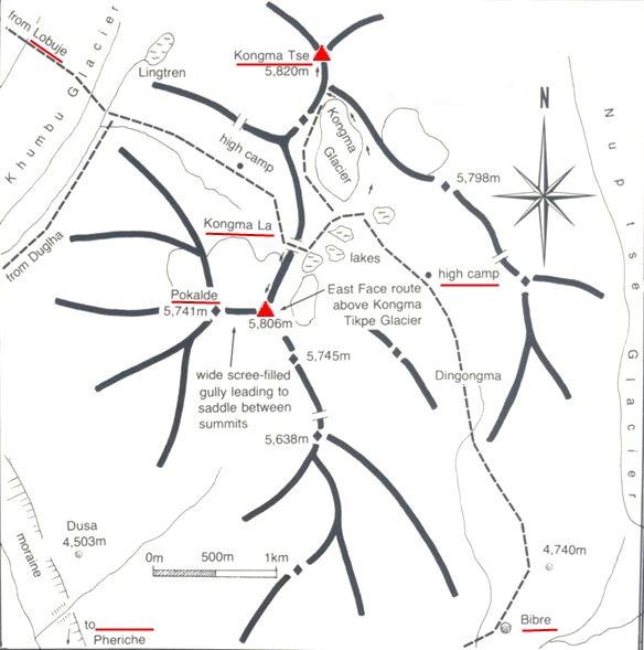 Route
Map for Kongma La
and ascent routes for Kongma Ri and Pokalde Trekking Peaks |
 |
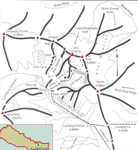 Location Map and
ascent routes for Kwande Ri
|
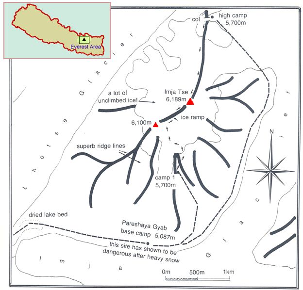
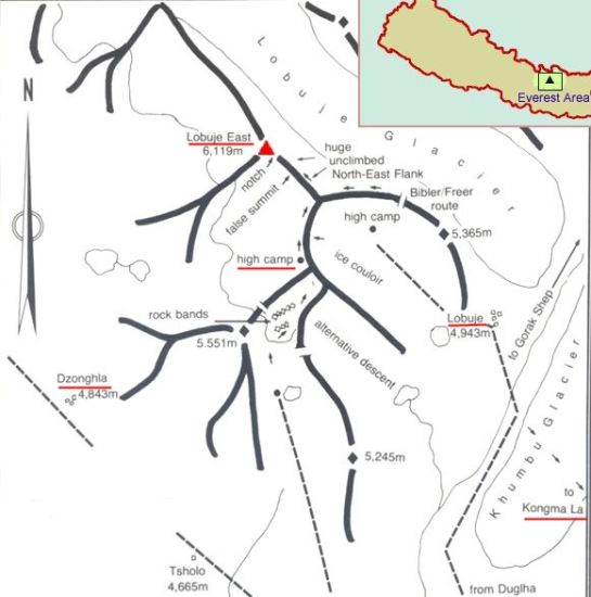 Route
Map for Lobuje East
|
 Route
Map for Renjo La |
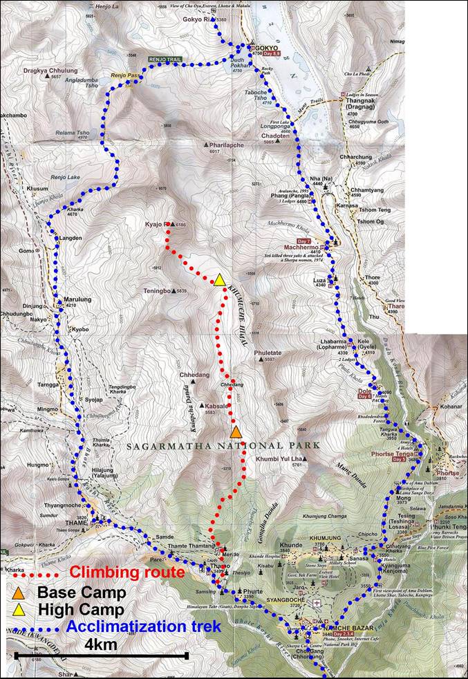 Route
Map for Renjo La |
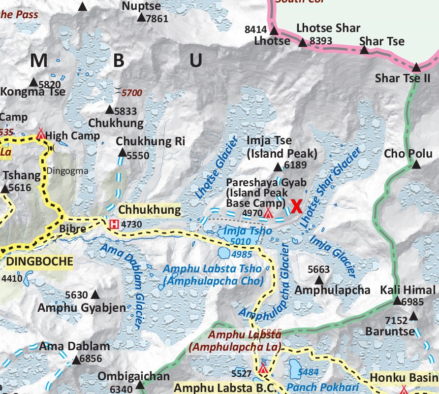 Map of Chukhung Valley
|
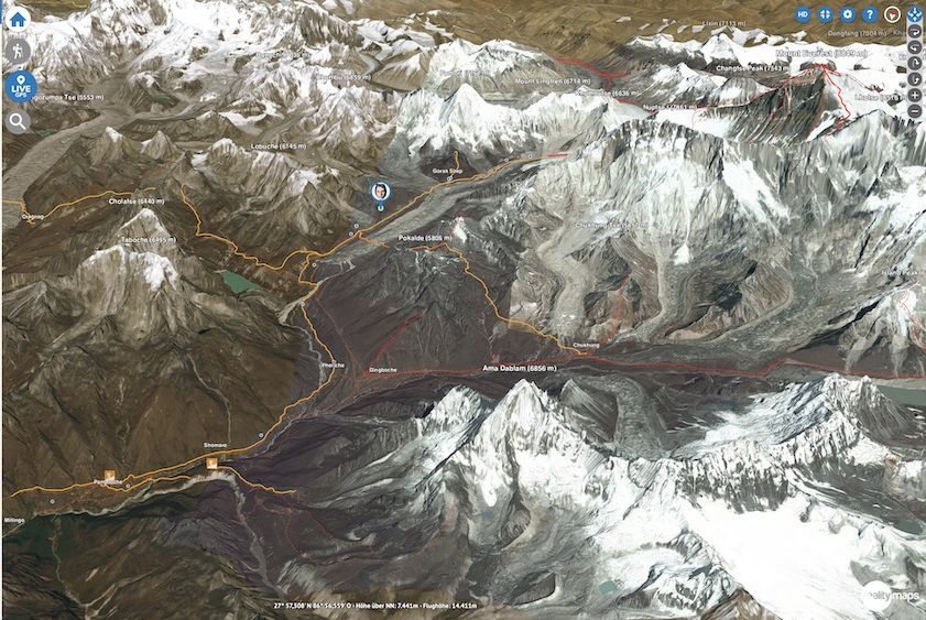
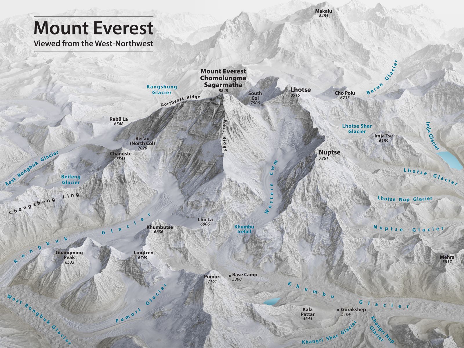 Everest
3D Map
|
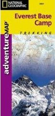
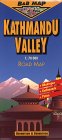
Everest Base Camp Map ( UK , USA )
Khumbu Region Map ( UK , USA )
Island Peak - Climbing Map ( UK , USA )
Himalaya Map - Nelles ( UK , USA )
Nepal Trail Map - Nelles ( UK , USA )
 , 8000ers,
7000ers
, Kallar Pattar
)
, 8000ers,
7000ers
, Kallar Pattar
)Nepal Climbs & Treks :: Nepal Photo Gallery :: Nepal Peaks :: Kathmandu
|
|
|
|
|
|