  |
The Scottish HighlandsCreag Mhor
|
  |
|
|
|
Cottage
above River Lochay |
|
|
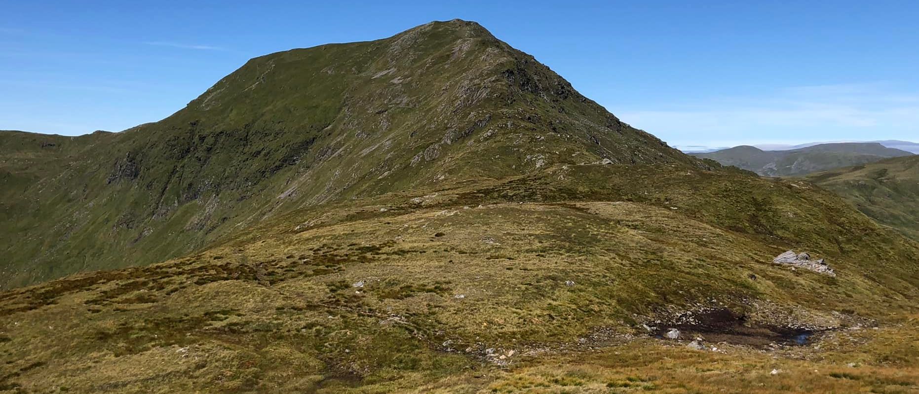
 Creag Mhor
above Glen Lochay |
|
|
Rock crags
on Creag Mhor |
|
|
|
|
|
Stob nan Clach
a Muro top on ascent of Creag Mhor |
 Summit Cone
of Creag Mhor |
|
|
|
|
|
|
|
|
|
|
|
|
|
|
|
Meall nan Sudh
and Tarmachan Ridge beyond Glen Lochay |
|
|
|
|
|
Location: Glen LochayMap: OS Landranger 63 ( GR260591 )
Distance: 16 miles ( 26km )
Time: 8 hours
Terrain: track and hillside
This Munro lies at the West end of Glen Lochay and it’s commonly linked with its higher neighbour Beinn Heasgarnich.
However you approach the hill, it’s a long way from the road head and linking it with Heasgarnich just makes for an even bigger
round, with moreascent too.
There’s really only one way to avoid sore feet and blisters and that’s to use a bicycle.
Fortuitously, Glen Lochay has an excellent, mostly level gravel track right to the foot of Creag Mhor.
A road bike might struggle on the stony track, but any simple off-roader will be fine.
Recent deciduous tree planting and track work at the head of the glen means the old car park is no longer available at Kenknock,
where the public road ends, and a new car park has been created a kilometre or so before this point.
Going down the glen, Creag Mhor and Beinn Heasgarnich are too close to appear anything other than craggy and massive
and it’s Ben Challum at the head of the glen which is the revelation, its impressively pointed profile imploring you to climb it.
If you are walking, then it’s just another reason to buy or borrow a bike.
At the byres and house of Betavaime the track divides, the left hand branch continuing up the glen to Lochan Chailein,
below Ben Challum, and the right-hand branch zig-zagging up the hillside to join a higher track contouring the hillside below Creag Mhor.
Leave the bikes, climb to the higher track and follow it left.
A short distance along, below Sron nan Eun, keep an eye out up on the right for a wooden gate which gives access through the wire fencing.
Continue to a gate from where an intermittent path ascends towards the boulder-strewn corrie forming the frontal face, which is
neither as far away or as steep as it looks.
Keep close to the burn draining the corrie to gain the ridge and follow it to the top.
The next objective is the Stob nan Clach, to the south, which is gained by descending grassy and rocky slopes to the bealach
Frith a’ Choirean, followed by a short, grassy ridge to the top.
After a short section of horizontal it is downhill all the way on a crag-scattered grassy ridge to the last top, named Sail Dhubh.
