The Corbetts - SMC Scottish Highlands Hillwalking Guide

 Southern Scotland

Hart Fell
The High Mountains of Britain & Ireland The Islands

 Photographs of a circular traverse of the Corbett Hart Fell

above Moffat in the Borders Region of Scotland
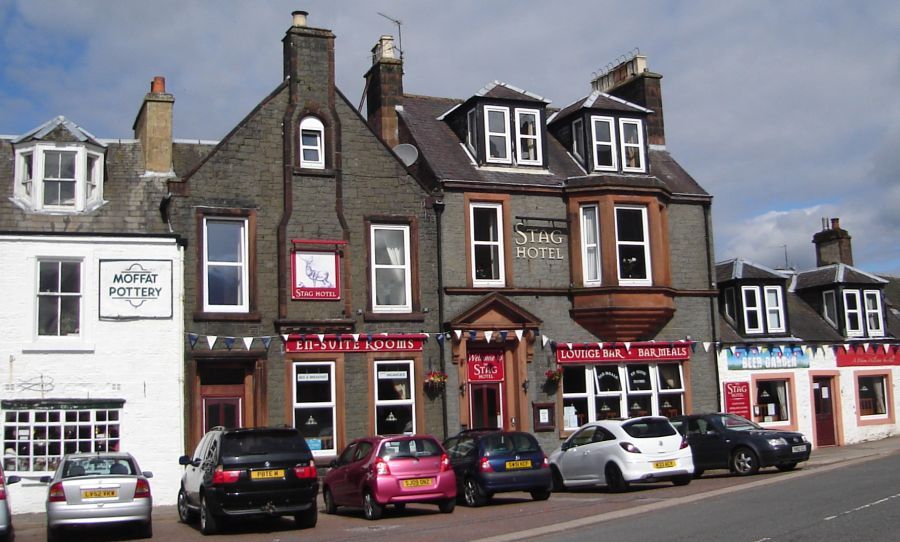

The Town of Moffat in the Borders Region of Southern Scotland

The Town of Moffat

Moffat is on the 
Southern Upland Way

- a long distance walk across the Borders Region

 of Scotland


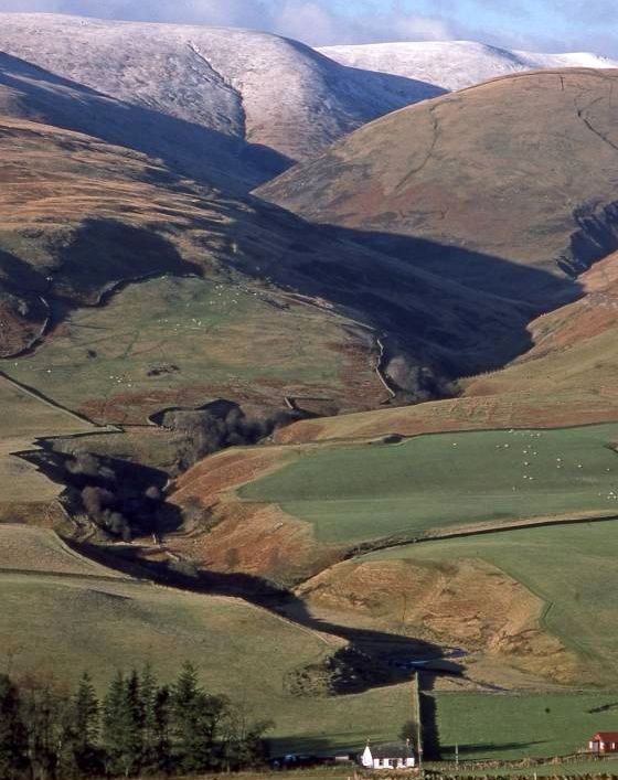
Bodespeck Law and Blackhope Burn at the start of the ascent of Hart Fell

Bodespeck Law and Blackhope Burn

 at the start of the ascent of Hart Fell


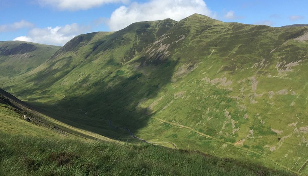
Saddle Yoke ( return route ) on ascent of Hart Fell

Saddle Yoke ( on the return route )

 on ascent of Hart Fell


Saddle Yoke ( return route ) on ascent of Hart Fell

Saddle Yoke ( on the return route )

 on ascent of Hart Fell


Goats on Swatt Fell

Goats on Swatt Fell


Saddle Yoke ( the return route ) from Hart Fell

Saddle Yoke ( the return route )

 from Hart Fell


Trig Point on summit of Hart Fell ( 2651ft, 808m )

Trig Point

 on summit of Hart Fell ( 2651ft, 808m )


White Coomb from Hart Fell


Broad Law from Hart Fell

 Broad Law

( the second highest - after Merrick

- of the Corbetts in the Borders region )

 from Hart Fell


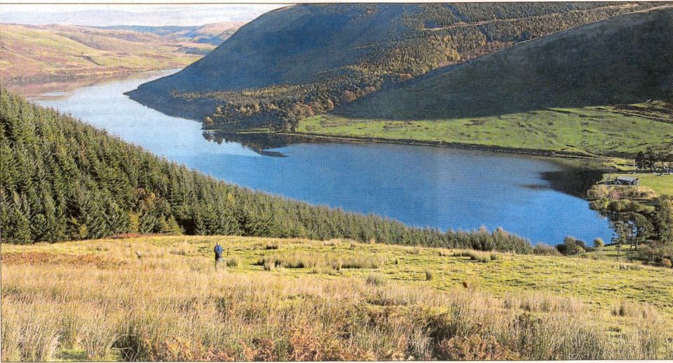
Fruid Reservoir on the traverse from Hart Fell to Saddle Yoke

Fruid Reservoir

 on the traverse from Hart Fell

 to Saddle Yoke


Swatt Fell above the Blackhope Burn

Swatt Fell ( the outward route )

 above the Blackhope Burn


Blackhope Burn on the traverse to Saddle Yoke

Blackhope Burn

 on the traverse

 to Saddle Yoke


Hart Fell on the traverse to Saddle Yoke

Hart Fell

 on the traverse

 to Saddle Yoke


Fruid Reservoir from Hart Fell


Swatt Fell from Saddle Yoke

Swatt Fell

 from
 Saddle Yoke


Hart Fell

Hart Fell


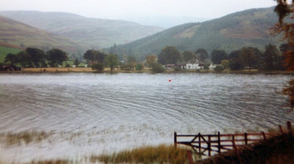
Loch of the Lowes near Moffat on the Southern Upland Way

Loch of the Lowes

 near Moffat

 
on the Southern Upland Way


Saint Mary's Loch near Moffat on the Southern Upland Way


Saint Mary's Loch near Moffat on the Southern Upland Way


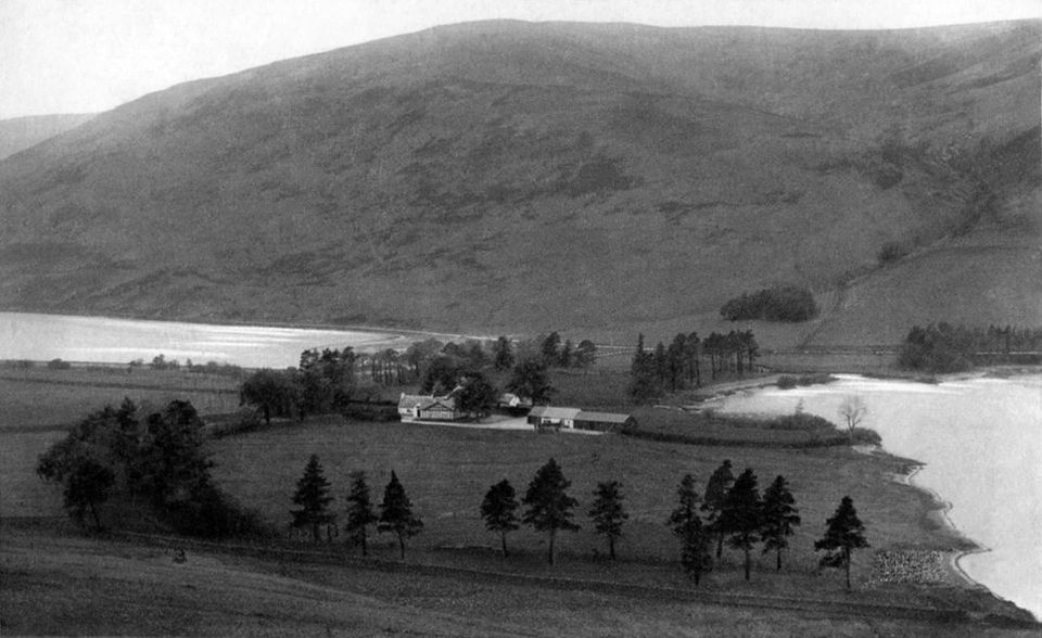
Saint Mary's Loch and Loch of the Lowes - old postcard

Saint Mary's Loch

 and Loch of the Lowes

 - old postcard


Route Description and map for Saint Mary's Loch

Route Map

 for Saint Mary's Loch


SAINT MARY'S LOCH WALK - ROUTE DESCRIPTION:

Location: Borders
Maps: OS Landranger Sheets 73 and 79
Distance: 5 miles ( 8km )
Time: 3-4 hours
Terrain: Good paths

A walk from Riskinhope to Dryhope Tower along the shores of Loch of the Lowes and St Mary's Loch, a stretch of water beautifully described by some of Scotland’s finest poets, is a terrific outing. lt’s a linear walk so it might be helpful to use two cars, or dump a bike at the finish and cycle back to the start once you're done. Ideally you’ll get someone to drop you off and pick you up later, or simply retrace your steps back to the starting point. Mallard, tufted duck, wigeon, goldeneye and common sandpiper can be seen in both lochs at most times of the year, so it’s handy to have a pair of binoculars with you.
The route from Tibbie Shiels Inn to Dryhope Tower follows the
Southern Upland Way, which runs for 212 miles ( 340km ) from Portpatrick to Cockburnspath and was opened at Tibbie Shiels Inn in 1984.
James Hogg -the Ettrick Shepherd and Sir Walter Scott were both patrons of the inn and Tibbie herself lived from 1782 to 1878. She is buried with her molecatcher husband Robert Richardson in Ettrick churchyard.
Dryhope Tower was the birthplace of Mary Scott, the Flower of Yarrow, in 1550. Mary was married to Auld Wat of Harden, apparently an ancestor of Walter Scott. Legend claims that in lean times Mary would serve her husband a pair of spurs on a serving tray, a strong hint that the cupboard was bare and it was time he raided some cattle.
Below Capper Law on the north shore of the loch is the site of the now vanished St Mary's Chapel, where William Wallace is said to have been appointed Warden of Scotland in 1297.
Leave the A708 at Chapelhope and follow the farm track to Riskinhope from where a path runs north-north-east to follow the east shore of Loch of the Lowes. The pike fishing here, and in neighbouring St Mary's Loch, is excellent. Cross the bridge over the Little Yarrow and make your way to Tibbie Shiels Inn, and join the route of the
Southern Upland Way.
Follow the SUW signs, along the sketchy path over grassy banks into pleasant woodland before crossing the bridge over the March Sike and continuing along the shoreside path to Bowerhope. Just past the house, the footpath merges with the main forest track and runs between the lochside and the forest to the bridge over the Yarrow Water.
Cross the bridge then immediately turn right, still following signs for the Way.
Follow the river now, to the footbridge over the Dryhope Burn. The route now lies in a north-west direction, crossing the main road then following two field edges to reach the Dryhope to Blackhouse track. Once on the track turn left, and go through a gate to the gaunt remains of Dryhope Tower, peaceful in its hillside setting and well protected by the Dryhope Burn in the east and the Kirkstead Burn in the west. Try to imagine those tumultuous times when the tower was built, before the return journey to Riskinhope.

Route:
Leave the A708 at Chapelhope ( GR: NT232191 ) and follow the farm track to Riskinhope from where a path runs NNE to follow the E shore of Loch
of the Lowes.
Cross the bridge over the Little Yarrow and TR to Ttbbie Shiels Inn, and join the
Southern Upland Way.
Follow SUW signs through the car park to a gate at the far end and then past the sailing clubhouse to another gate and a stile.
Cross and follow the sketchy path over a grassy bank.
Go through some woods.
Cross the bridge over the March Sike and continue on the lochside path to Bowerhope.
Past the house the footpath merges with the main forest track and continues to the bridge over the Yarrow Water.
Cross the bridge then immediately TR, still following SUW signs.
Go R along river bank to footbridge over the Dryhope Burn.
Continue NW, crossing the main road.
Follow two field edges to reach the Dryhope to Blackhouse track.
TL through a gate to Dryhope Tower ( GR: NY267245 ).


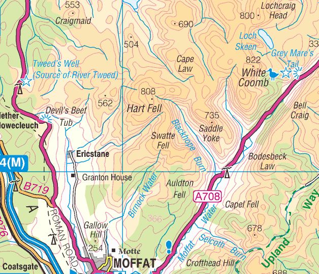
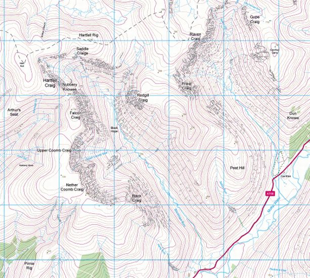
Map of Hart Fell

Map of Hart Fell


Map of Hart Fell

Map of Hart Fell


  Hart Fell Gallery Photo Gallery

<< BackSouthern Highlands : Next >>


Scotland Index :: The Scottish Peaks

Isle of Skye :: Isle of Arran

Knoydart :: Glencoe :: Ben Nevis :: NW Highlands :: Eastern Highlands :: Central Highlands


Worldwide Mountaineering :: Adventure Travel :: Site Index

fb icon  google+ icon Linkedin icon  twitter


b


Guide Books & Maps - Scotland:-


Arrochar Alps - Map Glasgow Popular Hills - Map West Highland Way - Map Loch Lomond North - Tyndrum, Crianlarich, Arrochar - OS Explorer Map Loch Lomond and Inverary OS Landranger Map

Isle of Arran OS Explorer Map Isle of Arran OS Landranger Map Arran - Official Tourist MapIona & Mull MapWestern Scotland & the Western Isles OS Road Map Northern Scotland OS Road MapSouthern Scotland OS Road Map


The Islands  The Isle of Arran Hill Walking on the Isle of Arran Island Walks - Southern Hebrides and Arran Ayrshire & Arran - 25 Walks

The Scottish IslandsAn Island Odyssey IslayScotland from the AirScotland's Coast

The High Mountains of Britain & Ireland  Munros Tables SMC  The Munros - Scotland's Highest Mountains  Scotland - Lonely Planet  NW Highlands - SMC Guide  Exploring the Far NW of Scotland  Guide to Walks in NW Highlands

Walking in Scotland - Lonely Planet Mountain: Exploring Britain's High Places  National 3 Peaks Walk Scottish Highlands Hillwalking Guide The Scottish Islands Bouldering in Scotland

Central Highlands: Six Long Distance Walks West Highland Way: Official GuideWest Highland Way: Rucksac ReadersWest Highland Way: TrailblazerThe West Highland WayWest Highland Way: Footprint MapWest Highland Way - Map West Highland Way - Map 100 Hillwalks around Glasgow

Pathfinder Guide: Fort William and Glen Coe Walks Rambler's Guide: Ben Nevis and Glen CoeGlencoe Rock & Ice Climbing The Munros: Scottish Mountaineering Club The Munros and Tops The Corbetts - SMC Munros & Corbetts Chart The High Mountains of Britain and Ireland Munro Almanac

The Munros - Scotland's highest mountains Call of the Corbetts Magic of the Munros Hamish's Mountain WalkThe Munros in WinterMy Scotland by Hamish MacInnes

Scottish Mountains - 50 Classic Routes50 More Routes on Scottish Mountains The High Mountains of Britain and Ireland Scotlands 100 Best Walks Scottish Mountains - 100 Best RoutesBig Walks of Great Britain Classic Walks in Britain & Ireland

Scottish Hill & Mountain Names Classic Mountain Scrambles in Scotland Classic Climbs - Central & Southern Highlands Mountaineering in Scotland and Undiscovered Scotland by W.H.MurrayMore Wilderness Walks Wilderness Walks Wilderness Walks 2 - Video Ski Mountaineering in Scotland

Ski Touring in ScotlandScrambles in Lochaber Rock Climbing in Scotland Rock Climbing SkillsThe FACE: Six Great Climbing Adventures Ben Nevis: Rock & Ice ClimbsGreat Snow & Ice Climbs of the British Isles100 Best Routes on Scottish Mountains One Man's Mountains - Tom Patey

A Mountaineer's Tale - W.H.MurrayDougal Haston: Philosophy of RiskThe Glens of Rannoch Southern Highlands - MapNorthern Highlands Central Highlands West Highlands Central Highlands SMCNW Highlands SMC

Scotland - Lonely PlanetScotland's Highlands & Islands - Lonley Planet Scotland's Highlands & Islands - Rough Guide Highlands & Islands of Scotland - Hidden Places Rough Guide ScotlandScottish Highlands & Islands - Rough Guide Rough Guide: Scotland Lonely Planet, Walking in ScotlandLonely Planet - Walking in Britain

50 Walks in the Scottish Highlands & Islands 100 Walks in ScotlandVisit Scotland - Touring Guide Scotland: Where to Stay - Hotels & Guest Houses Scotland: Where to Stay - Bed & Breakfast Hillwalker: The MunrosHillwalker: The Corbetts

Weather for Hillwakers & Climbers Mountain Weather Guide to the Weather Weather: Collins Gem Hillwalking Handbook for Mountain Leaders Hillwalkers Manual Hillwalkers Guide to Mountaineering First Aid on Mountains


Google Analytics


Google Analytics 

extremetracking
 eXTReMe Tracker


extremetracking
Sitelock caingram.com
SiteLock
Sitelock
Sitelock caingram.info
SiteLock
Sitelock