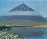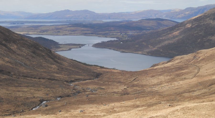
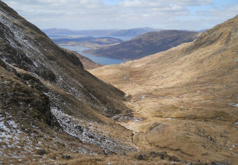
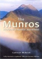
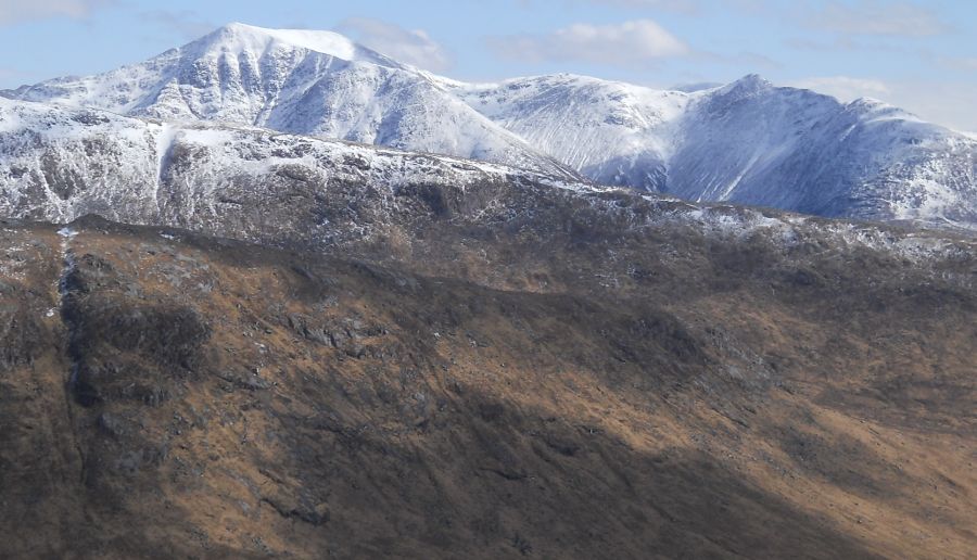
Loch
Creran
on ascent of Creach
Bheinn
|
|
Loch
Creran
on ascent of Creach
Bheinn
|
|
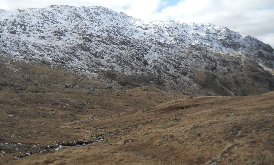
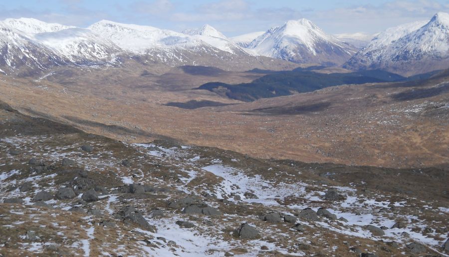
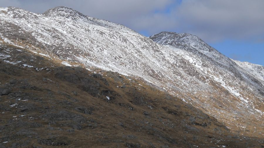
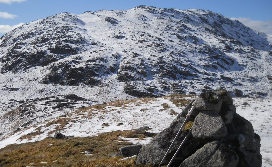
Meall Garbh
on ascent of Creach Bheinn
|
|
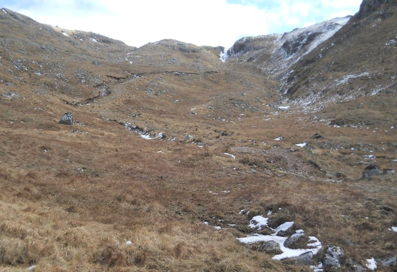
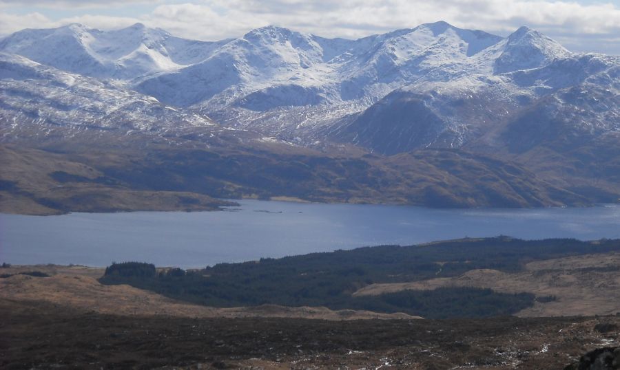
Loch
Creran from bealach ( col )
|
|
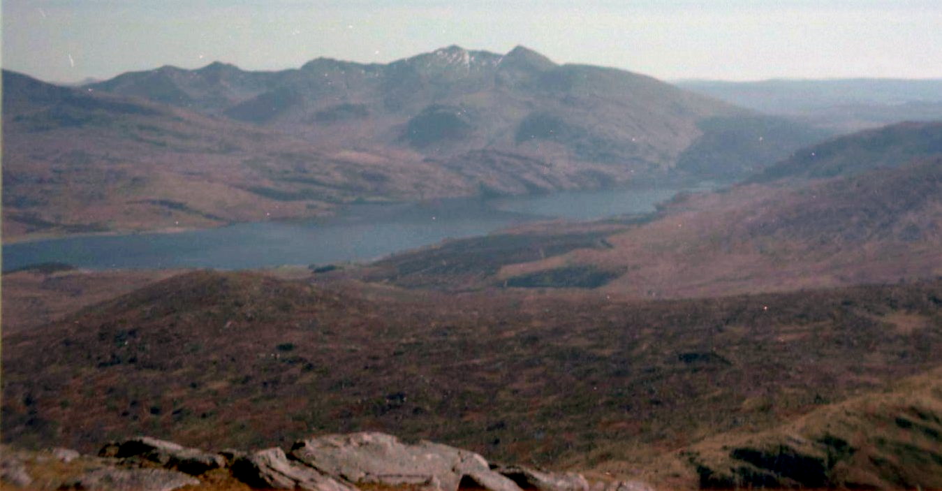
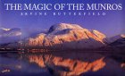
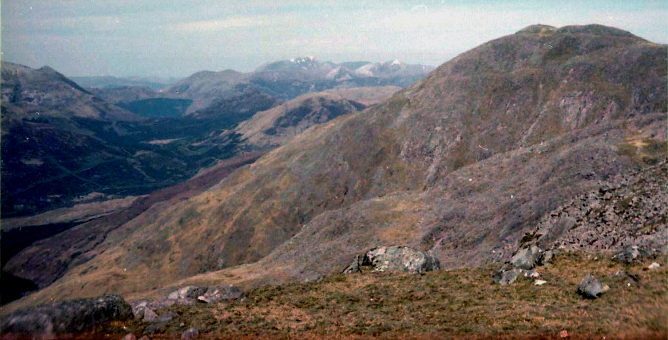
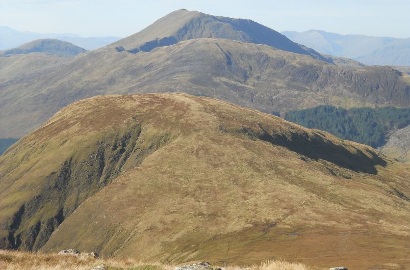
Munros
of the Glencoe Region
from Creach Bheinn
|
|
from the Corbett Creach Bheinn
|
|
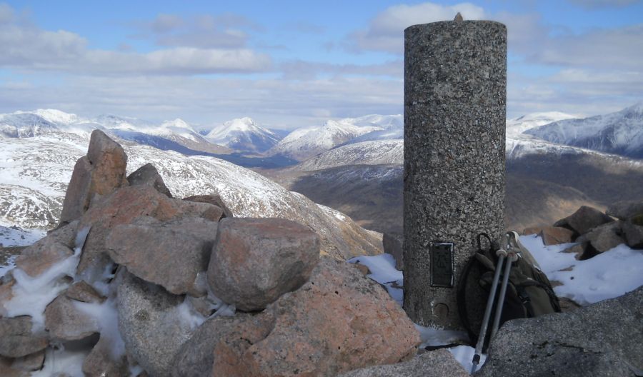
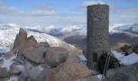
Trig
point on summit of Creach Bheinn ( 2657ft, 810m )
|
|
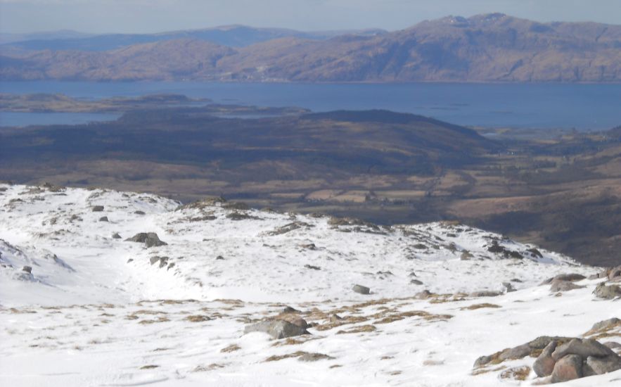
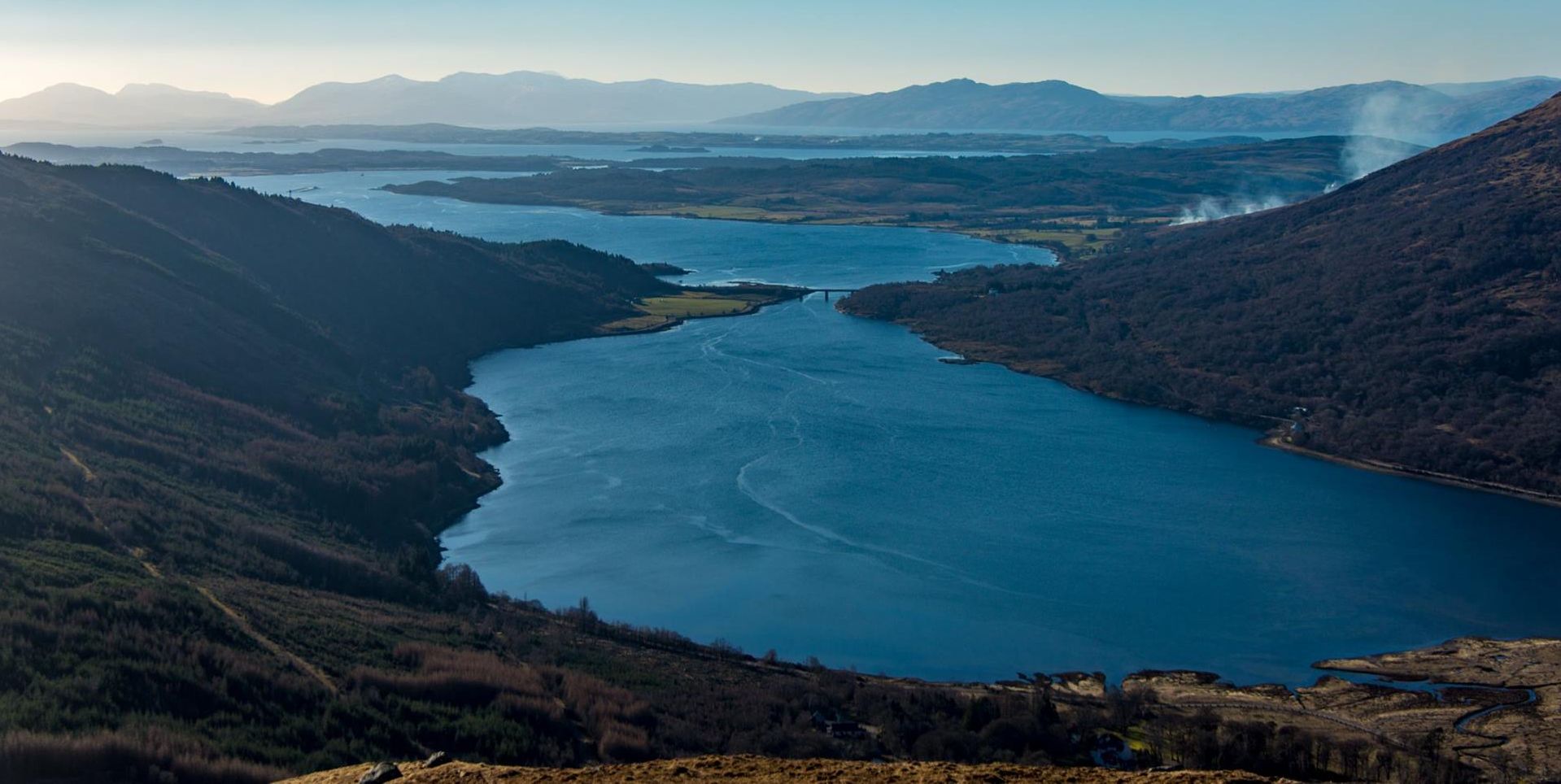
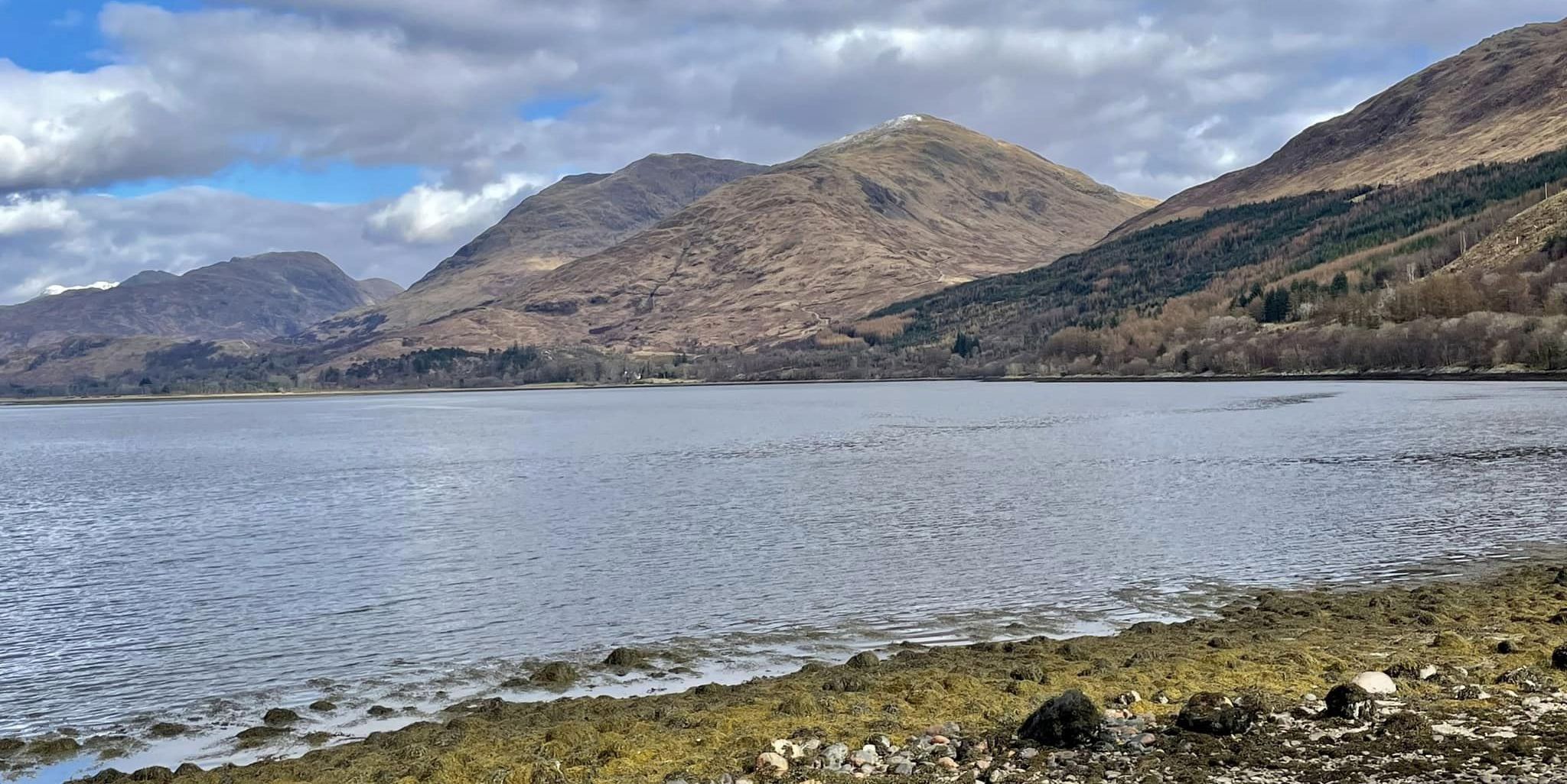
Loch
Linnhe
from Creach Bheinn
|
|
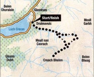
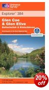
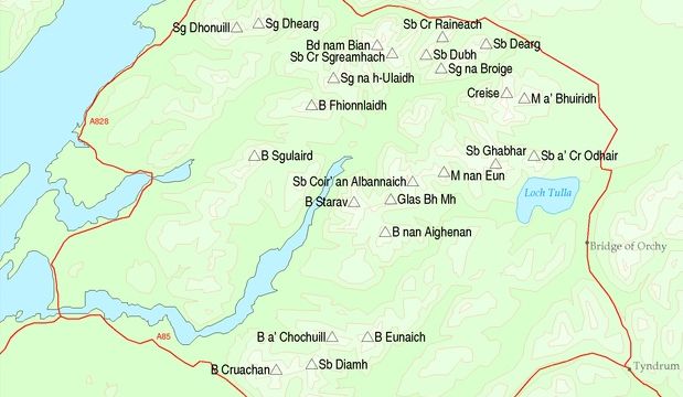
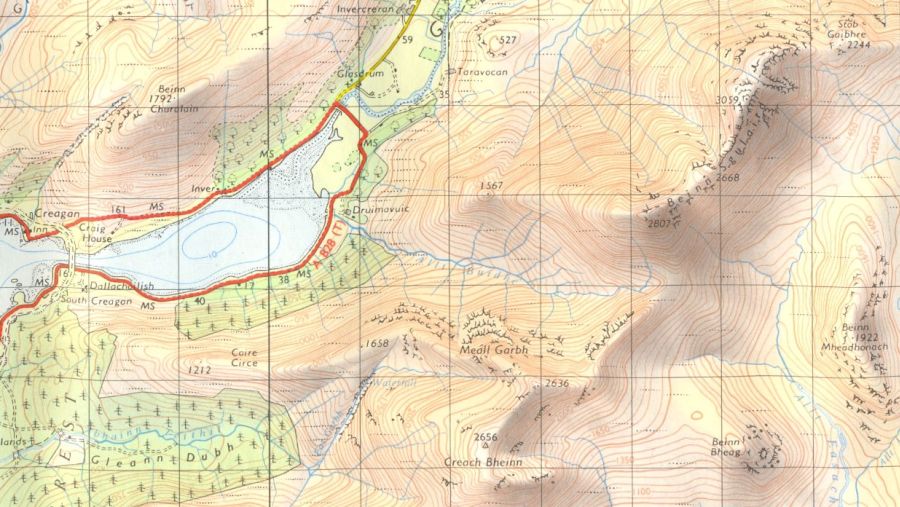
Route
Map for Creach Bheinn
|
|
CREACH
BHEINN -
ROUTE DESCRIPTION:
Location: Argyll and
Bute
Map: 06 Landranger 50
Distance: 8 miles (13km)
Time: 5-6 hours
Terrain: Moderate mountain walk
After
a long spell of cloud, rain and wind this was The Good Day and its
restorative qualities had me singing. The drive to Duror was
unspeclacular — a grey shroud of mist covered everything — but as I
drove across the
old railway bridge across the narrows of Loch Cretan I caught a glimpse
of the Munro, Beinn Sgulaird and its Corbett neighbour, Creach Bheinn,
rising from skirts of mist.
By the time l parked near Druimavuic and took the forest track into
Gleann Buidhe much of the mist had evaporated. The evergreens were
greener than ever, the deciduous trees were budding and the grasses on
the hill
were honey gold against a pale blue sky. A buzzard mewed its warning
call, no doubt marking its territory for the season ahead The day had
all the
vibrancy of spring, of new life and zest while, in essence, it was just
recovering
from the death throes of winter. A bulldozed track makes its way up the
glen to a high bealaeh between Beinn Sgulaird and Creach Bheinn. My
original thought was to gather in both summits from there but part of
me just wanted to linger, take photographs and while the day away among
the rocks and ridges of the high places. So I opted for Creach
Bheinn ( 2657ft / 810m ). Further west, where the best views would be,
out over the mouth of Loch Cretan to Eriska and Lismore and the high
ground of Morven beyond.
I shunned the track up the glen and simply followed the burn, the Allt
Buidhe, walking in time to its symphonies — not plodding up a man-made
highway and its echoes of despoilation and crudeness. Having spent
too long dictated to by other people‘s diaries and timetables. trying
to meet a barrage of deadlines and not, for human intervention reasons,
being able to take my usual late winter overseas trek, I was eager to
escape homo sapiens for at least a day - aiding in the choice of the
Corbett
over the usually busier Munro.
By following the burn l managed to avoid the bulldozed track but as I
wallowed in the sun on the high bealach, cnioying the views across
Beinn Trilleachean to Ben Starav in Glen Etive, walkers appeared -
intent,
like me, on climbing Creach Bheinn. I scampered off but as I climbed
the ridge to the intervening top of Creag na Cathaig I could hear their
chatter
behind. They were a happy bunch, enjoying the glorious weather, but
curmudgeonly me was irritated by their close presence. l stopped to
allow them to overtake, but they didn't, so I set off again and there
they were, only a few metres behind me now, blethering away. I stopped
again on
the steep climb up to Creach Bheinn's northeast top and this time they
all passed, so I lingered, ate my lunch, took photographs, drank
coffee, giving them time to reach the summit then begin their descent -
but I didn’t wait long enough. As I approached there they were,
sprawled out
over the cairn enjoying the sun and the views. I muttered a gruff
hello, took some more photographs and retired in a huff. I may not have
had the summit to myself but at least I could enjoy the descent on my
own. And l did.
I sincerely hope I didn’t appear rude, but sometimes it’s important to
be on your own. Now l could really appreciate the view — multi-topped
Cruachan, Starav, the twin Buachailles at the head of Glen Etive,
granity Sgulaird with the long ridge of Beinn Fhionnlaidh beyond and
the exquisite views across Loch Linnhe to Morven and Mull — and in the
south, the outline of the Paps of Jura.
I loped down the hill's north-west ridge and took a steep course back
to the Allt Buidhe. Avoiding the forestry, l crossed the burn again and
it wasn't until I was back in the woods above the road that I met more
people, a couple out for a stroll with their dog.
Route:
Start at the layby on the minor road north of Druimavuic at the east
end of Loch Cretan ( GR: NNOO7449 ).
Just before the driveway to Drulrnavuic a track leaves the roadside and
climbs through the woods. passing the stone walls oi the house gardens.
Beyond the walls the track goes through a fence beyond which there is a
junction.
Keep to the left and follow the track all the way to the high bealach
in Coire Buidhe between Beinn Sguiaird and Creach Bheinn.
From here follow the ridge in a SW direction. over Creag na Cathaig and
down to another bealach from where steep slopes climb to Creach Bhein's
NE top.
From here it's an easy walk to the summit.
Descend the may you came or alternatively, descend via the hill's NW
ridge from Creag na Cathaig, leaving it as it veers W to drop down
steep slopes back to the Allt Buidhe.
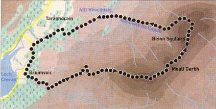
Route
Map for Beinn Sgulaird
|
|
BEINN
SGULAIRD -
ROUTE DESCRIPTION:
Location: Glen Creran
Map: 06
Landranger 50
Distance: 9
miles ( 14.5km )
Time: 5-6 hours
Terrain: tracks and paths
Beinn Sgulaird lies
at the south-western corner of an extensive area of granite stretching
from the western flanks of Ben Alder
to Beinn Cruachan. Rannoch Moor once covered by an ice sheet, dominates
the northern half. In contrast, the southern section is
marked by high craggy and complex peaks such as Starav, Albannaich and
Cruachan scoured from the bedrock as the
glaciers radiating from the ice sheet ploughed towards the sea.
Slightly west of the main Etive glacial trench, Beinn Sgulaird is
neither as high nor as complex as its cousins, but it is rough and
rocky and offers an excellent single-hill expedition from the head of
Loch Creran.
Follow the road up Glen Crerau to the head of the loch past Druimavuic
to park at a wide lay-by on the right just beyond the
second entrance to the house.
Walk back towards this entrance but turn left before it on to a rough
track with electricity poles.
The track leads through woods behind the house to open hillside where
it swings left then back right to cross the lower part of the
western ridge of point 863m.
Leave the track here for a cairned path and follow it directly up the
ridge. Climh up and south round point 488Sm, then north skirting a
small band of crags above the col.
Regain the path at the col’s high point and continue up th ridge to the
summit of point 863m. From here the going is much rockier as
you traverse the rim of the corrie to gain the top of Meall Garbh (
848m ).
Further rocky ground gains the south ridge which leads in a series of
granite slabs and steps to the large summit cairn ( 937m ).
You can retrace your steps or make a contouring descent by the pathless
west face, the latter being recommended only in good
visibility as some of the ground is complex and rocky.
Continue north on the path towards a rocky point ( 909m ) then drop
west off the crest of the ridge into the grassy gully leading
west from the col between the two summits. Follow this until you can
turn south-west aiming for the head of the loch and traverse
mostly grassy slopes between the bands of crags and scree.
Once clear of the rocks follow grassy, birch-scattered slopes towards a
walled sheepfold, gained by crossing the Allt Coire na Capull.
Cross the smaller Allt Bliochdaig beyond from where animal paths and
ATV tracks lead west to a track leading to the
access road south of Taraphocain.
Follow this west beside the River Ure to join the main road some 700m
north of the parking spot.
Glencoe
| Knoydart
| Isle
of Skye
| Isle of Arran
| The
West
Highland Way
The
Eastern
Highlands | The Central
Highlands
| The
Southern Highlands | The NW Highlands


 ::
Glencoe
Photo
Gallery
::
Glencoe
Photo
Gallery